Heading South
Friday was driving day. We had somewhat underestimated the time required to drive from Pukehina to Wellington, where we would catch the ferry to the South Island. Although the distance would suggest (assuming an 80 kph average out of a possible 100 kph maximum) a 5 hour trip, it turns out that there are several road features that trim that average speed below 80 kph.
We had wisely discussed this trip with some locals, and had taken their word for it that it was closer to a 7 hour trip, so with a 5:45 pm checkin time in Wellington, we got on the road at 8:30 am to leave ourselves time for lunch and a little cushion.
The drive from Pukehina to Rotorua we had done twice before and there were no surprises. From Rotorua you head south to Taupo, which is a tourist town based on lake frontage on the quite large freshwater lake (Lake Taupo - go figure). The drive to Taupo, except for getting trapped behind some pokey drivers was uneventful.
This is where the drive became a little surprising (for the driver - read "Harrowing" for Debbie). The road south out of Taupo leads along a very picturesque path following the southern edge of Lake Taupo. Unfortunately, the mountains nearby didn't leave enough room between the mountain and the lake for the road engineers to leave wide lanes, or to take out the sharp hairpin turns. Or to put up sturdy barriers to prevent you from plunging off the edge into the lake.
There are apparently some mountains between Taupo and Wellington. Our road map does not show these, but they are there, and the road winds along between the valleys, with very few passing lanes built.
Just keep in mind that this is Highway #1, the main route from the north of the island to the south of the island ... from Auckland, the largest city, to Wellington, the nation's capital. It completely defies belief how many hairpin corners, rated at 25 kph, there are in this road. I found the constant curves challenging and, as I said, Debbie found it harrowing.
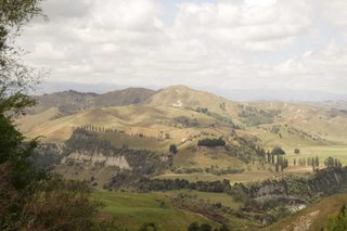
We stopped at one of the scenic rest stops and took a few pics. Here's one.
On the other side of the mountains, the terrain changes abruptly. On the north side, there are lush mixed forests. We drove past the last hill, and found ourselves in a dry terrain, with nary a tree in sight. For those of you who have seen Lord of the Rings, the south side was exactly as you would expect Rohan to be. Low scrub, short grasses, and dry. It was kinda cool to see the sudden change.
The desert terrain lasted an hour or so, and then slowly became more treed and flat. The road south led eventually to the edge of the ocean, at which point the road engineers again adopted the curvy, jerky approach.
The road leading into Wellington proper opens into a 4 lane road, although not exclusively limited access, and leads down through a very impressive cleft between two small mountains before turning into a 4 lane city street.
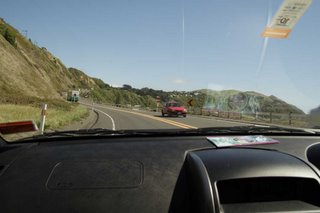
Here is a shot Debbie took as we approached Wellington. Three significant things to notice. One ... I'm driving on the shoulder but not as far as the picture might suggest. Two ... See how sharply the terrain falls off once the road ends. This road has huge shoulders compared to the stuff through the mountains. Three ... Check out the "No Right Turn" sign - seriously, do they think this might be a problem?
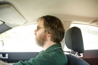
Check out how completely comfortable this guy is driving in this city.
We located the ferry terminal, and because of our early departure, we still had an hour and a bit before we were required to check in. We headed into Wellington to scope out the city a little more closely.
Wellington is a port city and is built around a large protected harbour. We gassed up the car and asked the attendant for directions to any waterfront cafe at which we might while away the last hour before checkin. We followed his advice and drove down toward a public pier. Unfortunately the pier was closed to the public, and we were forced to turn around.
As I executed a 3 point turn, the front bumper caught on a low, protruding wooden barrier, and was mildly, but obviously damaged. We were quite distraught at this as you might imagine. The rental car has a NZ$2100 deductible, so we will be buying a new bumper for this Mitsubishi.
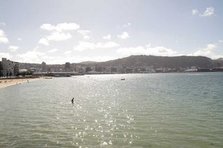
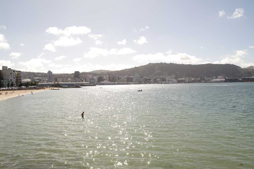
We drove off without further mishap, and stopped at a beachfront cafe to grumble together at our misfortune. Here is a pic of two unhappy campers.

Here is a shot of the Wellington downtown from the same vantage point.
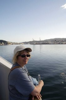
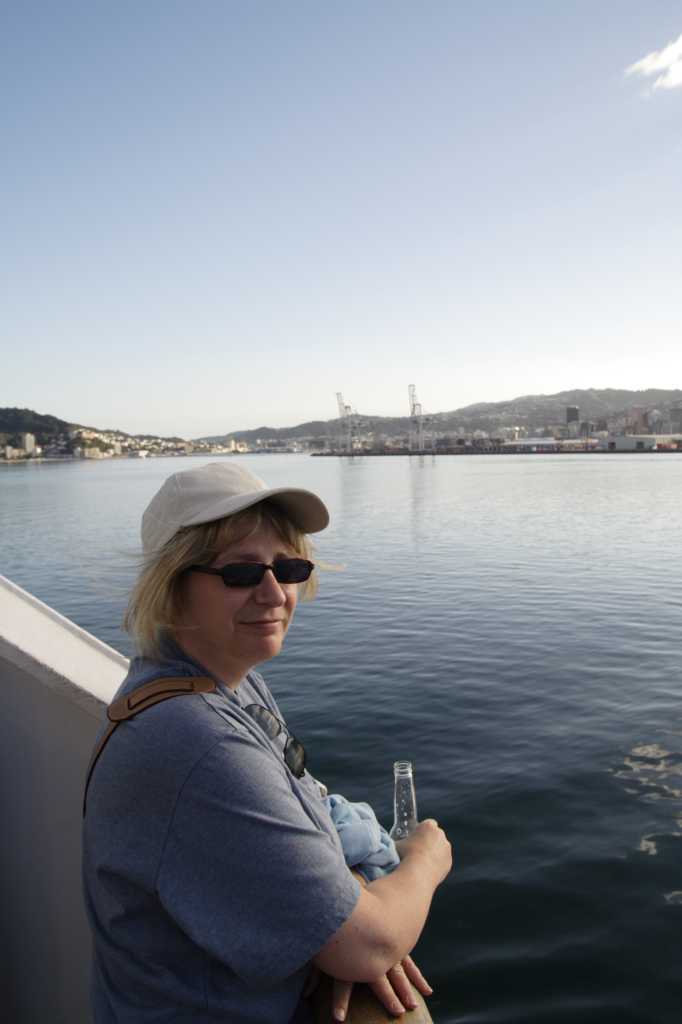
We dropped the rental car off at the Avis outlet attached to the ferry terminal, and after filling out some forms about the accident, packed our luggage off to the ferry check-in. The interisland ferry takes about 3 1/2 hours to get from Wellington on the north island to Picton on the south island. We set ourselves up at a table near the stern rail of the ferry, and with a wave at the north island as it passed away (and a couple of consoling drinks), put the rental car incident behind us.
Here's Debbie leaving her troubles, if not her credit card balance, behind.
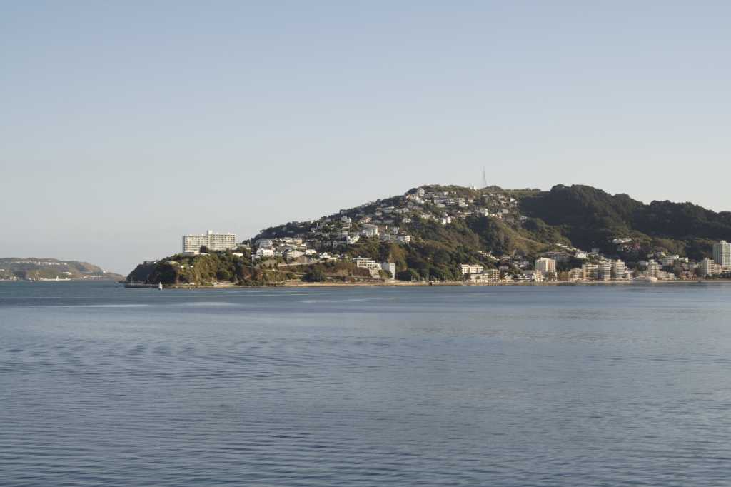
This is a view of a Wellington suberb. Makes Maple seem kinda sad in comparison.
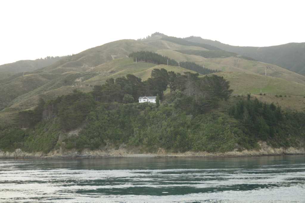
Someone lives here. What they do for a living I couldn't guess unless there's more money in watching ferries go by than I would have supposed.

We picked up our new rental car at the south island ferry terminal, and after our luggage came off the luggage carousel drove to our one night stay at the Americano motel. We have nothing either nice or derogatory to say about the Americano. It was fine.
We found one restaurant out of the 10 or more on the main drag of Picton that would still serve us some dinner, ate, and retired exhausted to our little room (three single beds - that's all that was left).
But Saturday's another day ...
Don
We had wisely discussed this trip with some locals, and had taken their word for it that it was closer to a 7 hour trip, so with a 5:45 pm checkin time in Wellington, we got on the road at 8:30 am to leave ourselves time for lunch and a little cushion.
The drive from Pukehina to Rotorua we had done twice before and there were no surprises. From Rotorua you head south to Taupo, which is a tourist town based on lake frontage on the quite large freshwater lake (Lake Taupo - go figure). The drive to Taupo, except for getting trapped behind some pokey drivers was uneventful.
This is where the drive became a little surprising (for the driver - read "Harrowing" for Debbie). The road south out of Taupo leads along a very picturesque path following the southern edge of Lake Taupo. Unfortunately, the mountains nearby didn't leave enough room between the mountain and the lake for the road engineers to leave wide lanes, or to take out the sharp hairpin turns. Or to put up sturdy barriers to prevent you from plunging off the edge into the lake.
There are apparently some mountains between Taupo and Wellington. Our road map does not show these, but they are there, and the road winds along between the valleys, with very few passing lanes built.
Just keep in mind that this is Highway #1, the main route from the north of the island to the south of the island ... from Auckland, the largest city, to Wellington, the nation's capital. It completely defies belief how many hairpin corners, rated at 25 kph, there are in this road. I found the constant curves challenging and, as I said, Debbie found it harrowing.
We stopped at one of the scenic rest stops and took a few pics. Here's one.

On the other side of the mountains, the terrain changes abruptly. On the north side, there are lush mixed forests. We drove past the last hill, and found ourselves in a dry terrain, with nary a tree in sight. For those of you who have seen Lord of the Rings, the south side was exactly as you would expect Rohan to be. Low scrub, short grasses, and dry. It was kinda cool to see the sudden change.
The desert terrain lasted an hour or so, and then slowly became more treed and flat. The road south led eventually to the edge of the ocean, at which point the road engineers again adopted the curvy, jerky approach.
The road leading into Wellington proper opens into a 4 lane road, although not exclusively limited access, and leads down through a very impressive cleft between two small mountains before turning into a 4 lane city street.
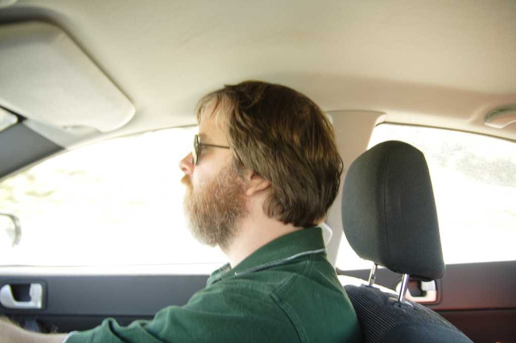
Here is a shot Debbie took as we approached Wellington. Three significant things to notice. One ... I'm driving on the shoulder but not as far as the picture might suggest. Two ... See how sharply the terrain falls off once the road ends. This road has huge shoulders compared to the stuff through the mountains. Three ... Check out the "No Right Turn" sign - seriously, do they think this might be a problem?

Check out how completely comfortable this guy is driving in this city.
We located the ferry terminal, and because of our early departure, we still had an hour and a bit before we were required to check in. We headed into Wellington to scope out the city a little more closely.
Wellington is a port city and is built around a large protected harbour. We gassed up the car and asked the attendant for directions to any waterfront cafe at which we might while away the last hour before checkin. We followed his advice and drove down toward a public pier. Unfortunately the pier was closed to the public, and we were forced to turn around.
As I executed a 3 point turn, the front bumper caught on a low, protruding wooden barrier, and was mildly, but obviously damaged. We were quite distraught at this as you might imagine. The rental car has a NZ$2100 deductible, so we will be buying a new bumper for this Mitsubishi.
We drove off without further mishap, and stopped at a beachfront cafe to grumble together at our misfortune. Here is a pic of two unhappy campers.
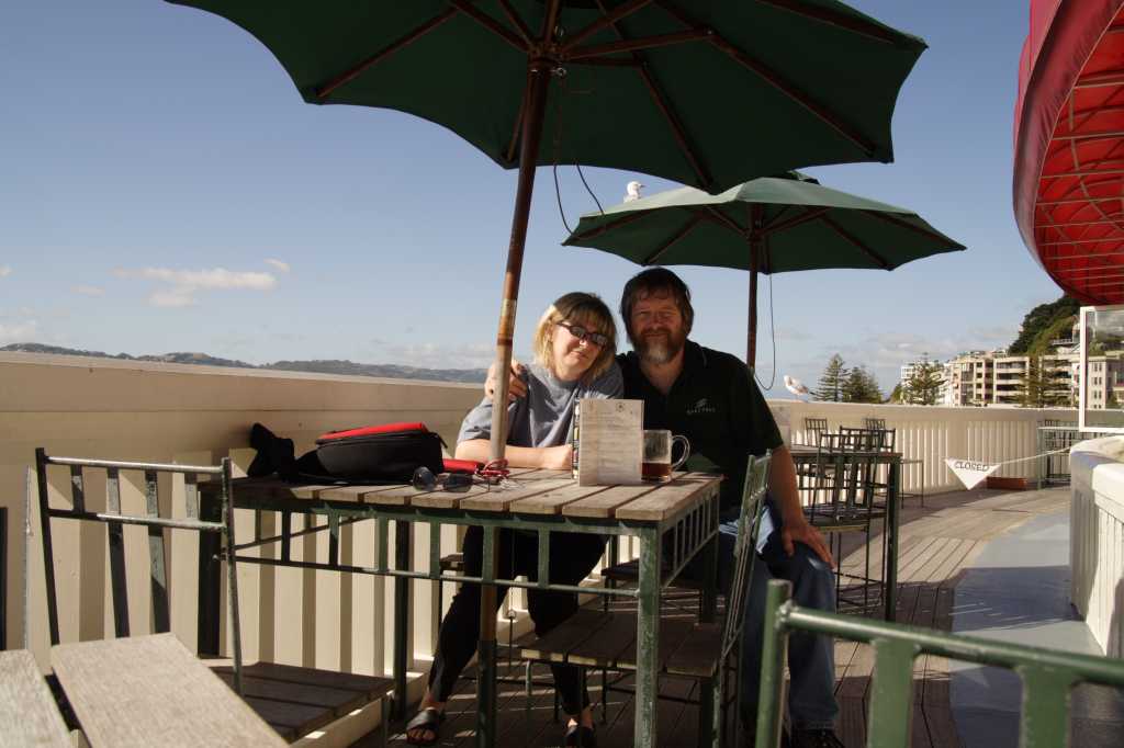
Here is a shot of the Wellington downtown from the same vantage point.
We dropped the rental car off at the Avis outlet attached to the ferry terminal, and after filling out some forms about the accident, packed our luggage off to the ferry check-in. The interisland ferry takes about 3 1/2 hours to get from Wellington on the north island to Picton on the south island. We set ourselves up at a table near the stern rail of the ferry, and with a wave at the north island as it passed away (and a couple of consoling drinks), put the rental car incident behind us.
Here's Debbie leaving her troubles, if not her credit card balance, behind.
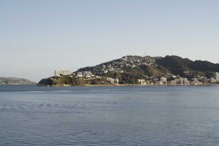
This is a view of a Wellington suberb. Makes Maple seem kinda sad in comparison.
Someone lives here. What they do for a living I couldn't guess unless there's more money in watching ferries go by than I would have supposed.
We picked up our new rental car at the south island ferry terminal, and after our luggage came off the luggage carousel drove to our one night stay at the Americano motel. We have nothing either nice or derogatory to say about the Americano. It was fine.
We found one restaurant out of the 10 or more on the main drag of Picton that would still serve us some dinner, ate, and retired exhausted to our little room (three single beds - that's all that was left).
But Saturday's another day ...
Don
posted by Don at
6:20 pm
![]()

1 Comments:
Someone lives here. What they do for a living I couldn't guess
From the looks of things they're protecting the last few trees from the onslaught of the white poles.
By Anonymous, at 4:37 am
Post a Comment
<< Home